Wednesday, January 11, 2017

Why is Hawaii the Rainbow Capitol of the World?


Does Hawaii have the Best Rainbows on the Planet?  

The short answer to this question is yes, Hawaii has the most and best rainbows.  Even our sports teams are called the Rainbows. Rainbow in Hawaiian is "ānuenue." In this post, I will try to explain the special circumstances in Hawaii's environment that make rainbows so brilliant and so frequent over our state.  Then I will talk about the Rainbow Stop and the new Rainbow App.


First some basics

To see a rainbow, we need to have sun low in one part of the sky and rain in another.  An observer can then see a rainbow if his/her back is to the sun and facing the rain shower.   A combination of refraction of sunlight as it enters and leaves the drop, and reflection at the back of the drop makes the rainbow visible to the observer, provided the sun is low enough in the sky so that the top of the bow is above the horizon.  The top of the rainbow appears at an angle of ~42 degrees above the head of the observers shadow. 


As the sun moves higher in the sky, the top of the rainbow moves lower.  The photo below is of a shallow rainbow produced by a sun that is rising higher in the morning sky.


Since violet light is refracted more than red light, the top of the bow is red and the bottom of the bow is violet.  See graphic and photo below.


So why is Hawaii the best place on the planet to view rainbows?

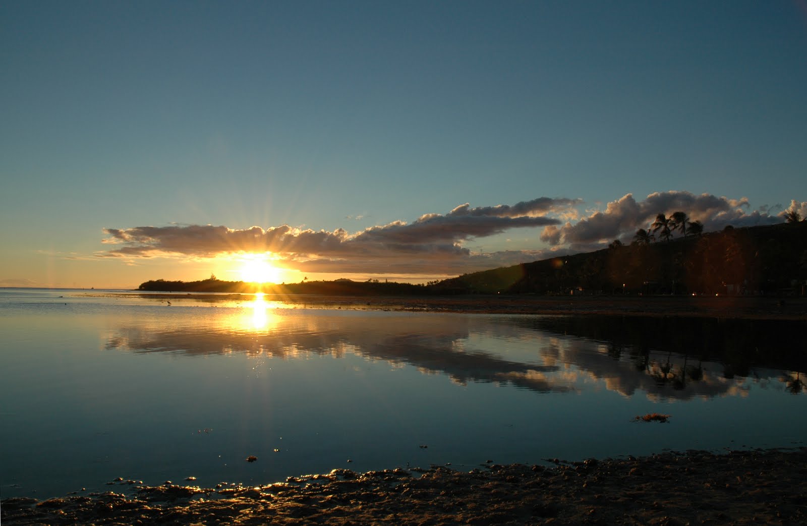
Now we can apply the basics above to help answer this question.  Hawaii certainly has bright sunlight, as a result of clean air and blue skies.  Except for an occasional influx of volcanic haze, also known as "vog," the air around Hawaii is exceptionally clean.  See how bright and white the sunlight is in the photo below, even though the sun is touching the horizon.  White light has all the colors that a rainbow needs.


The other ingredient required for a rainbow is rain.  And the rain has to fall from an isolated shower to allow the sunshine to reach under the cloud.  That's why rain from stratiform clouds don't produce many rainbows (see photo below taken in the Pacific Northwest). Blues skies and isolated showers are common in the prevailing trade winds that dominate Hawaii's weather.  See "The Flight of the Laysan Albatross" for more on trade wind weather.  


The Role of Clean Ocean Air


It is the clean marine air mass that surrounds Hawaii that ensures that small clouds produce plenty of rain.  The reason is that small cumulus clouds in clean trade wind air have fewer cloud droplets competing for the available water vapor.  Each cloud droplet forms on a particle in the air that allows the growing droplet to overcome "surface tension," the energy needed to create a new bit of interface between air and water.  Without these particles, also known as aerosol, the saturation in clouds would need to reach ~400% for condensation to take place and a cloud droplet to form. In clean air with fewer aerosol, cloud droplets grow larger than they would in polluted air.  A few large salt aerosol that are pulled up into the cloud from near the sea surface ensures that the growing Hawaiian cloud has everything it needs to produce rain.  The salt aerosol creates an extra large cloud droplet that soon begins to fall and sweep up smaller droplets in its path.  We call this process coalescence and it is particularly efficient in clean marine cumulus clouds (see photo below from Al Riordan).  The resulting rain is referred to as "warm rain."  In mainland air with lots more dust, pollen, and pollution, the small cumulus clouds don't rain because there are very many very small droplets and no large drops to trigger rain.  Under typical mainland conditions, taller clouds that contain ice crystals are needed to produce rain, in a "cold cloud" process that I will explain further in a future post.


The Important Role of Hawaii's Steep Mountains

There is yet another important factor at play in making Hawaii the rainbow capitol of the Planet.  Hawaii has an engine that makes rainbows appear even on drier days, and that is Hawaii's lush green mountains.  In the photo below, notice how the cumulus cloud preferentially forms over the Koolau Mountains.  That is because the mountains force the ocean air to rise and cool, causing cloud formation and rain.  I'll say more about this in a future post as well.


Here is a link to a time-lapse loop of a Koolau Mountain Rainbow 

So what is a Rainbow Stop?

In summary, Hawaii has clean air, bright sunshine, warm rains from isolated showers that are enhanced by our mountainous terrain.  It is a perfect combination to produce lots of spectacular rainbows.  In fact I was approached by a French professor who wanted to come to Hawaii on Sabbatical especially for the purpose of studying rainbows.  He is still working on the funding.  But he has identified the right location for sure.  The best time to find rainbows is early and late in the day for the optimum low sun angles.  In Hawaii mornings tend to have more showers, so early risers get the bow.  Now to answer the question of what is a rainbow stop?  Many people have complained to me that they often see rainbows while driving on the freeway and can't stop to appreciate them without causing a traffic jam.  So my friend Paul Cynn (with me in the photo below) came up with the idea of creating Rainbow Stops where folks can go to get the best view of our rainbows.  


Below is a draft map of Oahu I created that shows red stars for good viewing locations: Rainbow Stops.  The starred locations are lookouts and beach parks with excellent exposure to the sky.  But, when should folks go to the Rainbow Stops?  Anytime is a good time to stop and admire out beautiful skies.  However, that is where the Rainbow App comes in.  


What is the Rainbow App?

The Rainbow App is a smartphone app that uses information from radar and satellite along with your location and the sun's position in the sky to create a short term forecast or "nowcast" of where the most likely places are to see a rainbow during the next hour or so.  The app is currently being coded by scientists in my school, SOEST, at UHM.  If you want to learn more about the Rainbow App and Rainbow Stops go to http://rainbowstop.org.  On this site you can also learn more about double rainbows, moonbows, and fogbows.  The photo of a fogbow below taken by me at the summit of Mauna Kea, could be the highest rainbow in Hawaii.  And please email me your best rainbow photos and we will share them on our site. 


Finally, the proof is in the photos....

Below are a selection of rainbow photographs taken by my colleague at UHM, Minghui Chen.  Not only is Ming an excellent rainbow photographer, he is also the lead programmer for the Rainbow App.  I will announce when the App is available on this blog.  A hui hou.


Below is a rainbow with a reflection.  This is possible to see if you can find still water or in this case wet pavement to reflect the bow.


Below is a rainbow with the Koolau Mountains in the background


Below is a rainbow seen from Diamond Head


Below is the lower part of a rainbow with the Koolau Mountains behind.


Monday, December 26, 2016

The Flight of the Laysan Albatross


The fresh trades are making the Laysan Albatross particularly happy today. This installment will explore why these elegant birds move so fast through the air, the origin of the strong trade winds today, why the Albatross are so pleased with this weather, how these magnificent birds fly long distances over the ocean with so little effort, and why the geography and meteorology of Kaena Point makes that location such a paradise for a growing colony of Laysan Albatross.

So why do Laysan Albatross fly so fast? Newton's third law of motion tells us that for horizontal flight, the lift on a birds wing must equal the weight of bird.  The lift is proportional to the bird's velocity squared times the area of its wing. Thus, the greater a bird’s weight, the faster a bird must move through the air to have sufficient lift to allow horizontal flight. For the large Laysan Albatross this cruising speed works out to 36 mph relative to the air!  


Enhanced Trade Winds


The Honolulu Airport is reporting winds blowing 15 to 25 mph with higher gusts today, December 26th 2016. These winds are the result of an enhanced pressure gradient, a change in pressure over a distance, between a strong surface high-pressure area to our north and lower pressure nearer the equator in the Intertropical Convergence Zone or ITCZ (area of white clouds at the bottom of the figure below). The image below shows infrared satellite image overlaid with sea-level pressure contours in green for 8 AM this morning. Winds barbs are also plotted in white with the feathers indicating the wind speed and the staff indicating the wind direction, from the northeast.  Strong trade winds are forecast to continue through the week this week.


Return winds aloft are bringing high clouds (yellow and red colors) over Hawaii from the southwest as seen in the colored IR image below. High winds from the southwest and low level winds from the northeast is a hallmark of the Hadley circulation that dominates our weather over the Hawaiian Islands. I will expand on the science behind the Hadley circulation in a future blog.


Dynamic Soaring

Back to the Laysan Albatross. The Laysan albatross glides just above the waves for long distances without flapping its wings. How does it do this? In 1883, Lord Rayleigh first suggested that a bird could continuously soar in nearly-circular flight on an inclined plane that crosses a thin wind–shear layer. He correctly observed that the birds extract energy from the increase in wind speed with height near the surface of the ocean, aka the "wind-shear layer" (see figure below).  In a trick called "dynamic soaring" the albatross turns into the wind to gain height while losing air speed (~30 mph) and turns away from the wind and dives to gain air speed (~60 mph).  This is akin to a bicycle rider gaining speed while coasting down a steep hill and losing speed cycling uphill (converting kinetic energy into gravitational potential energy).  However, the bird gains elevation fast, like taking an elevator, just by turning into the wind shear without having to do work, smart bird!


Kaena Point

Finally, why is Kaena Point such an ideal place for an Albatross colony? Kaena Point is the westernmost tip of land on the island of Oʻahu. 


In 2011, the United States' first predator proof fence was constructed at Ka’ena Point, costing ~ $290,000.[6] The fence is approximately 2,133 feet long, and encompasses 59 acres of land.[7] The total population of Laysan Albatross fledglings, Wedge-tailed Shearwater fledglings, Ohia, Sandalwood trees, and several other species have risen significantly since the fence was installed.[8]  


Aside from the protected habitat, much of the point is comprised of sand dunes that form a low hill that is easy for the wind to traverse, yet to the east the Waianae mountain range forms a formidable barrier to the wind.  In the photo below you can see the west end of the Waianae mountains and if you look close you may be able to spot the fence running along the bottom.  As a result of the orography, or terrain, the wind accelerates across Kaena Point like a wind tunnel.


And so the Laysan Albatross happily soars into the sky on fresh trade winds accelerated by Oahu's steep orography.


Saturday, December 17, 2016

2016 Kona Low

This weekend our weather is dominated by a kona low.


What are Kona Lows?

Kona lows are subtropical cyclones that occur during the cool season in the north central Pacific.  They form as a result of forcing by upper-level lows cut off from the polar westerlies in winter.  Kona lows are cold core with the strongest circulation in middle and upper atmosphere.  They are relatively long lived storms - often affecting Hawaii for a week or more.  Erratic tracks and convective-scale organization of precipitation makes forecasting Kona Low impacts a challenge.


Kona Low Impacts Include:

  • heavy rains, flash floods, and landslides
  • high winds
  • large waves and swell
  • blizzards at higher elevations on Mauna Kea and Mauna Loa
  • severe thunderstorms
  • large hail 
  • tornados 

Below is an F1 tornado over central Oahu.


Blizzard on Mauna Kea came with 130 MPH winds in 2001.


The Kona Low Impacting us This Weekend

A well-developed Kona Low is dominating our weather this weekend.  Cool and showery weather has descended on the Hawaiian Islands as a Kona Low approaches the state from the north.  Here is the IR satellite image for 9 AM on Saturday 12/17/16.


The surface low is about 200 mi north of Kauai as seen in the surface pressure analysis that is overlaid on the IR satellite image for 8 AM today.


Kona Lows are generated by cold air and low pressure aloft, aka a trough aloft.  Below is the 250-mb height field overlaid on the water-vapor image for 8 AM today.


MKWC high-resolution weather model output shows showers circling the low center where the coldest air is aloft.  A vigorous convective band is seen just west of the Big Island.  


IR Satellite image for 8 PM today shows deep convection forming over Kauai and the Big Island, with the threat of heavy rain over Maui indicated.


Heavy rainbands are already impacting the Big Island this evening. See the radar reflectivity for 7 PM this evening below.


As time goes on, the model forecasts the low to slip southwest and for the bands of showers to continue to move over the Big Island.   See the forecast for 8 PM Sunday below.  The smaller islands may escape the worst of the heavy rains, if the model is correct.  However, weather models have difficulty correctly simulating the details of the convective showers and rainbands in Kona Lows.  In addition, the models tend to weaken the lows too quickly.  From past experience I would say we are not out of the woods yet.  So be prepared for the possibility of thunderstorms forming over Oahu during the next couple of days.